Exploring the Cape Town Peninsula
We had been on a family holiday to southern France for two weeks before we said goodbye to our companions and caught a plane from Paris to Munich in Germany. From here we had a long overnight flight to Cape Town airport where we were picked up by the first of our very efficient ‘transfers’ and taken to the other side of Cape Town on the Atlantic Ocean Coastline to our home for the next three days, the Twelve Apostles Hotel. It was a lovely ‘old world’ hotel that was named after the mountain peaks behind it (the ‘Twelve Apostles’). It was a hotel with great views of the ocean but no access to getting closer to the water due to the nature of the rugged foreshore. For our first day in our hotel, we were happy with relaxing and recovering from our night flight from Munich.
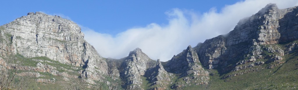
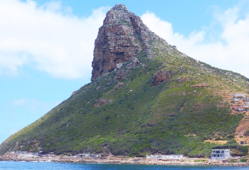
We had booked a full day’s tour for our second day in Cape Town which started off with our guide driving us to the city’s famous world heritage site, Table Mountain. The photo on the left below is of Lion’s Head which is part of an extended green space that runs across the city’s landscape behind the suburbs on the Atlantic Ocean coastline. Our guide told us that Lion’s head was a popular place for local joggers and walkers who regularly take to the road up this peak on weekends. On the right below is a view of Table Mountain from where the cable cars start their journey up the escarpment to the top of the mountain.
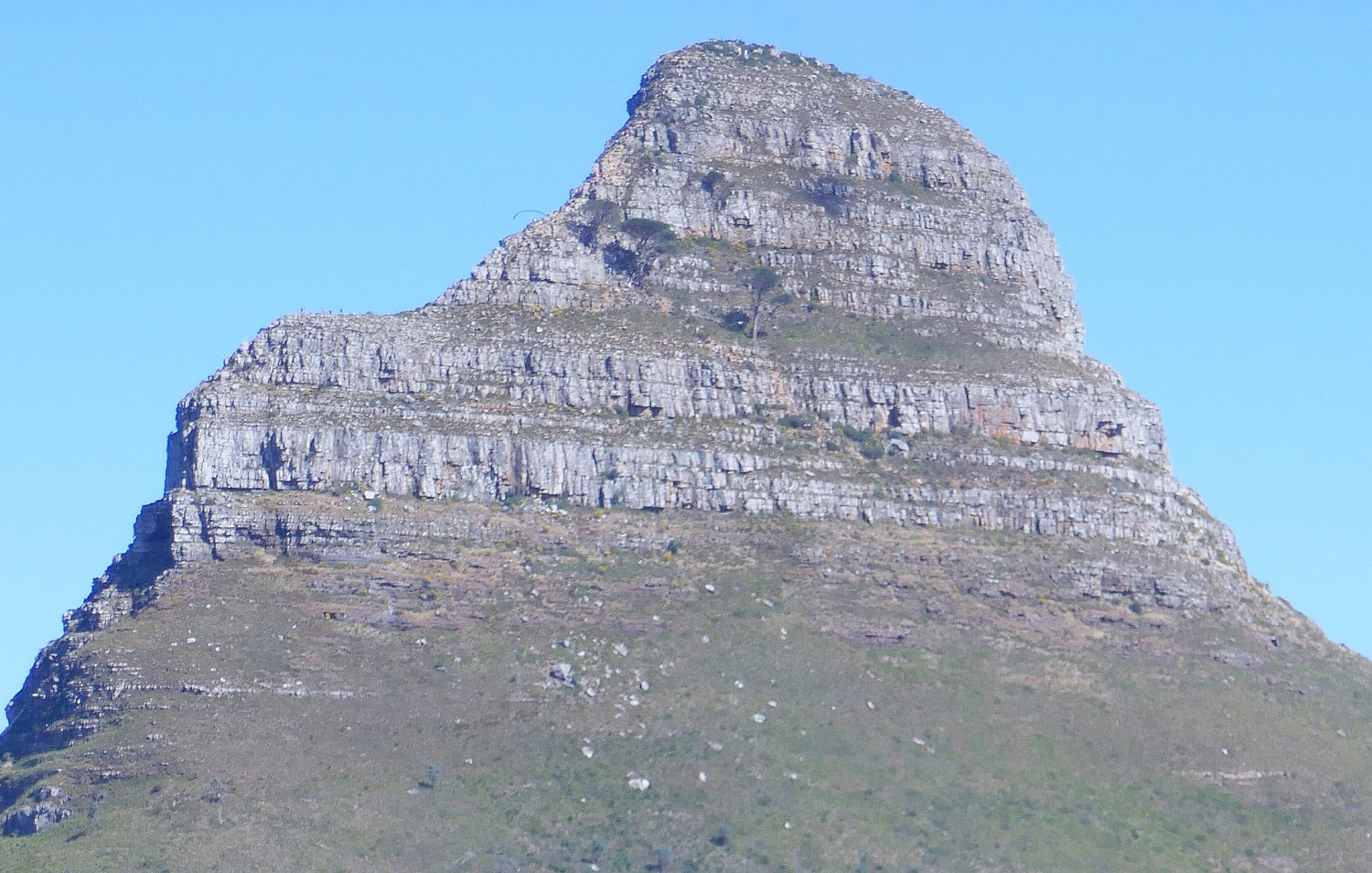
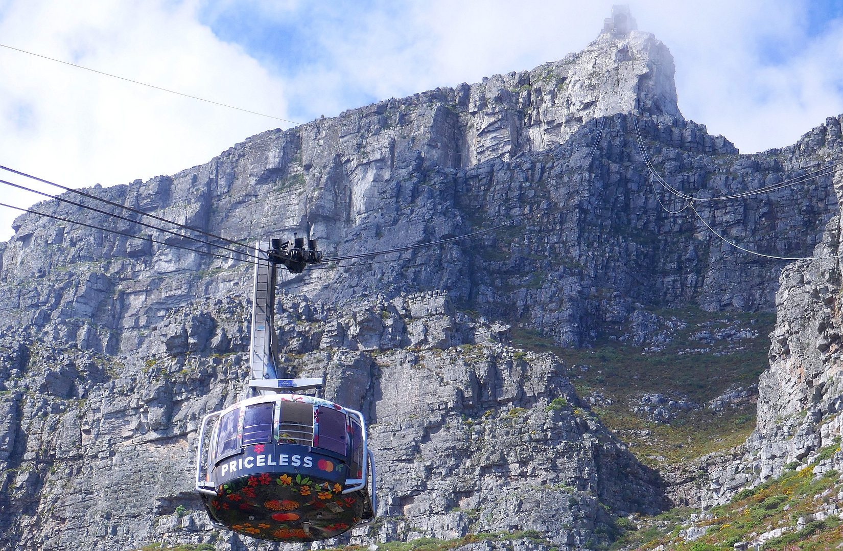

Table Mountain is described as an official ‘7 Wonder of Nature’ and its height is 1085 metres at its highest point. The cable car system that takes visitors to the top of the mountain is a spectacular piece of engineering in itself; each cable car can hold 65 people providing them with glorious views as the cable cars glide up the mountain. The cables themselves are 1200m in length, each weighing 18 tonnes. One curious aspect about the cable cars is that they carry 3000 litres of water in the base of each cable car as ballast during the windy season as well as being part of the supply of fresh water for the tourists up on the mountain.

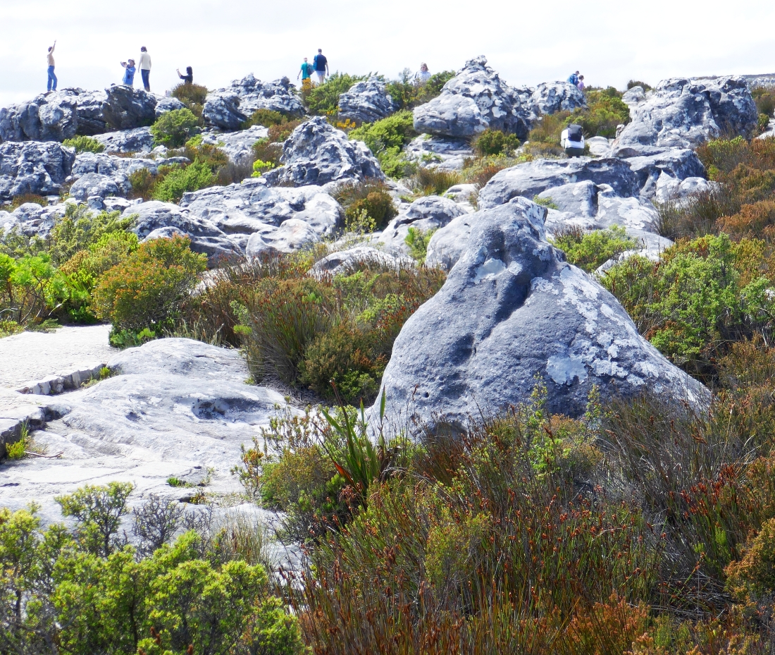
Once up on the top of Table Mountain, our guide took us on a tour of the area where the pathways led us through the curious mountain flora and fauna. One of the plants that he we stopped and examined was a heathland shrub with yellow flowers. He explained that this Fynbos vegetation was fire prone and can be part of the cause of natural fires if the conditions are ‘right’.
We explored the paths that spread over the top of Table Mountain and enjoyed the many views that looked over Cape Town and the surrounding valleys. We enjoyed our time wandering this high country but our guide had a plan for a long day of sightseeing so we returned to the cable cars and headed back down the mountain to our vehicle.


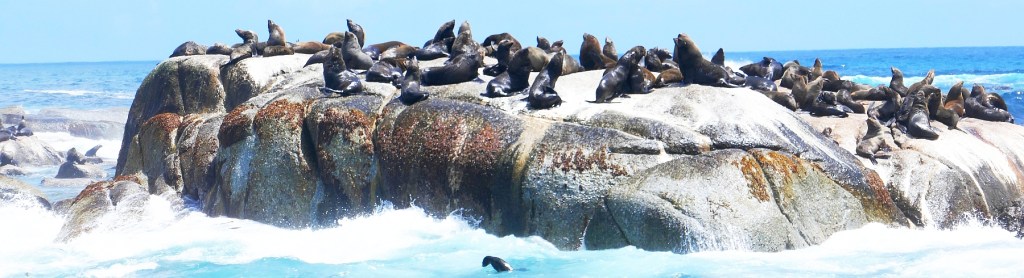
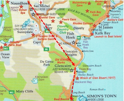
As visitors to Cape Town, we had very little idea of the geography of the peninsula that ran directly south of the city all the way down to Cape Point. Exploring this peninsula was the aim of our day and our driver drove around the large expanse of Table Mountain National Park and took the road through Constantia all the way to our second stop of the morning, Hout Bay. Our destination at Hout Bay was a small island off the headland here, famous for its large community of Cape Fur Seals. Duiker Island as its known is only 0.4 hectares in size (77 by 95 metres) but it certainly is home to huge numbers of seals.
Hout Bay is described as a seaside suburb of Cape Town despite being twenty kilometres south of the central business district of the city. It is situated in a valley that leads down to Hout Bay which connects to the Atlantic Ocean. The image to the right is of Sentinel Peak which marks the western end of the mouth of Hout Bay.


By the time we got to Hout Bay we were ready for some morning coffee. The dock area was very busy here where the ferry to Duiker Island ran from. A close look at the image to the right above shows the ferry sign indicating that the next tour out to the seal island left at 11am so after coffee, we had some time to stroll around the harbour area where there were a lot of sellers of African wood carvings promoting their wares.
The trip out to the seal island was very pleasant; Hout Bay is surrounded by large, peaked mountains and they were an impressive back drop to our ferry ride.

It didn’t take long to reach Duiker Island and I had to admit that I have never seen such large numbers of huge seals congregating together on small, rocky islets that made up the larger ‘island’. The ferry slowly floated its way along the various rocky out-crops and we were able to watch some seals coming and going while the majority of the seals basked in the sun before it was there time to do some morning breakfast hunting.
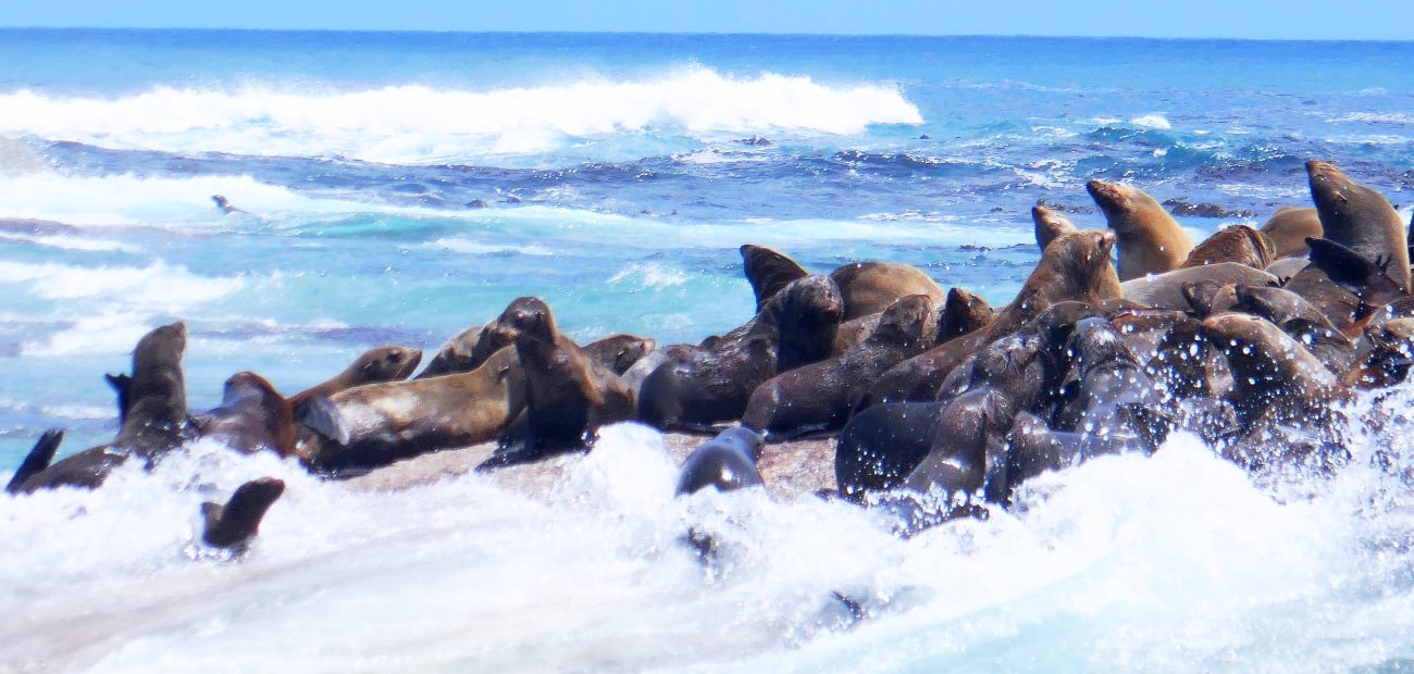
It looked like the seal population of Duiker Island was too large for the number of seals wanting to gain a sunny spot on the rocks to dry out and process their breakfast. The photo to the right below showed that some of the rocks were lower than others and seals washing ashore with the waves sometimes had difficulty clinging to rock surface before they were washed out to sea again!. This meant that they had to have another go at at gaining purchase on their home rock.

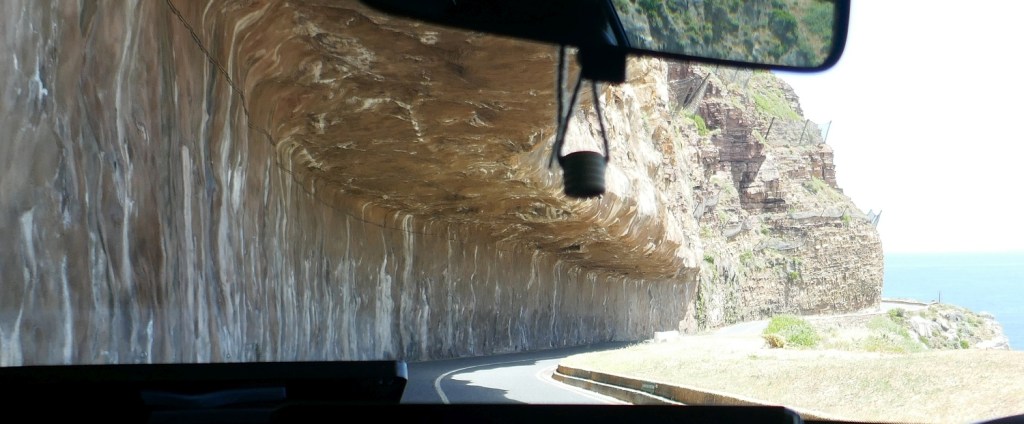
From Hout Bay our next destination on this Cape Town peninsula was the town of Noordhoek. The attraction of this section of the drive wasn’t so much our destination but the famous toll road, Chapman’s Peak Drive, that got us there. The publicity for this drive is that “it is one of the most spectacular marine drives in the world.” The image to the left here is an undercut into the cliff face to enable the cars and trucks to put sufficient distance between them and the cliff faces that make up one side of the drive. It is a road that was first built during World War 1 and has always been a controversial road due to its difficult location and the problems in maintaining the road from both man-made and natural disasters.
Our next destination was Simon’s Town and there were a couple of things that were on our list to check out; the first one was to find ourselves a decent lunch. This was very easy. We also got a view in our lunch cafe out over the town’s harbour towards South Africa’s largest naval base, located on the shores of False Bay.
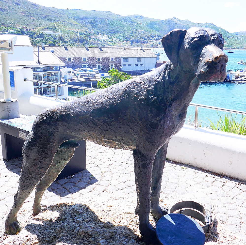
There was a fair amount of public art in Simon’s Town. The town itself was named after an early Governor of the Cape Colony, Simon van der Stel. However it seemed that to our guide, the most important statue in town was of a famous local dog. The dog had the curious name of ‘Just Nuisance’ and is the only dog ever to be enlisted in the country’s navy.
However the major tourist attraction in Simon’s Town was another creature from the depth’s of False Bay, the African Penguins. These were located outside the town at Boulder’s Beach. The colony of Penguins have enjoyed the hospitality of the locals since 1985; there are no records of these birds living here before that date.


CAPE TOWN…Day 2 continued
