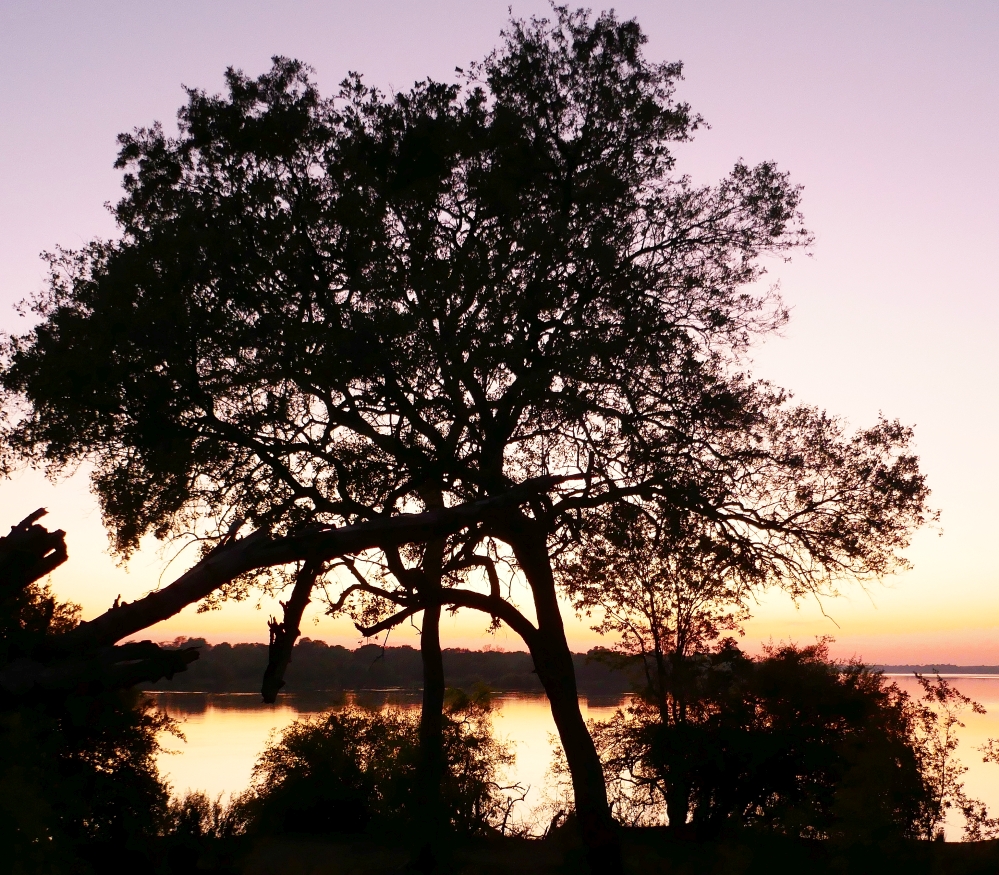
To the right is an early morning photo from our verandah. It shows that the sun isn’t far from breaking above the horizon and the Zambezi River. We had to be up reasonably early this morning due to the fact that we needed to get breakfast out of the way before we headed into the town of Victoria Falls and our morning’s walk along the chasm where the Zimbezi river broke into its many shapes and sizes of the Victoria Falls.


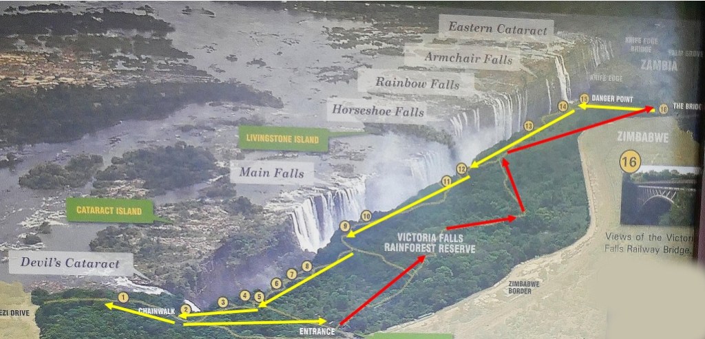
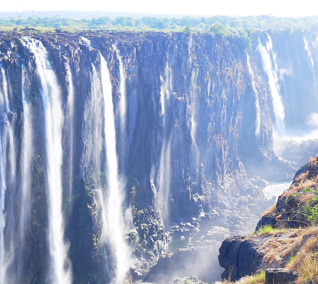
The Victoria Falls is a world famous series of waterfalls where the Zambezi River flows over a large, level sheet of Basalt in a shallow valley and falls into a large chasm (the First Gorge) that is between 80 and 108 metres deep. It is located on the border between Zimbabwe and Zambia. It is not the world’s highest or widest waterfalls but it is classified as the largest waterfall in the world due to its combined width. The diagram below shows the series of waterfalls that flow over into the chasm which then flows into a series of gorges and the Zambezi’s water eventually enters the Indian Ocean on the coast of Mozambique.
Our inspection of Victoria Falls required us to walk to where the bridge that links Zambia and Zimbabwe was located (Red arrows below). This trail took us to where the first waterfall, the Eastern Cataract, is located.
The rock formations that are the basis of Victoria Falls were laid down over 180 million years ago when Africa was part of Gondwanaland. The break up of Gondwanaland led to giant cracks in the basalt rock which eventually led to the sequence of gorges which the Zambezi River now runs through.
From the bridge over the Zambezi, we walked to our first lookout point which had the rather foreboding name of Danger Point. Zimbabwe isn’t really ‘big’ on its safety rules to prevent foolhardy tourists from plummeting over the cliff edge of one of the world’s largest water-falls. Each lookout point had a circular pile of stones to mark the lookout and along the edge of the cliff, there were low wooden railings that would not prevent a small dog from jumping over the edge. The only significant barriers that I noted were thorny branches of some low growing shrub that certainly made me stand back from this barrier. Anybody determined to stand on the very edge of the precipice and then fall over would be scarred by the thorny bushes before hitting the bottom of the cliff and picking up another collection of fatal wounds!
Our guide pointed out that this lookout had a lot of awkward rocky surfaces so he asked us to be very careful if we decided to get much closer to the edge.


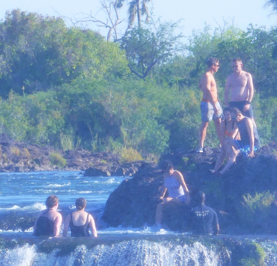
One of the things I didn’t notice when we were checking out the bridge that crosses the Zambeze River was that it was a site where the adventurous could get up to all sorts of dangerous activities if they were so inclined. One website described Victoria Falls as the ‘Adventure Capital of Africa’! The sign to the left above not only referenced abseiling near the bridge, but the adrenalin junkies could also apparently take part in “bridge-swinging, tandem parachuting, white-water rafting, and swimming in the world-famous Devil’s Pool.”


In the two images below, people can be seen (presumably ‘adrenalin junkies’) who have made their way to the Devil’s Pool that sits on top of one of the waterfalls on the Zambian side of Victoria Falls. It was described on one web site as “Arguably the most extreme infinity pool in the world.” Call me conservative but if I wanted to swim in an ‘Infinity’ pool, I wouldn’t choose one that sits next to the edge of Victoria Falls.

Our trip to Victoria Falls was in the dry season which had one advantage…the amount of spray from the falls meant that the atmosphere around the falls was reasonably free of the misty atmosphere that is prevalent during the wet season. This is the period when the amount of water coming down the Zambezi River is much higher and photographers apparently struggle during that period to get clear photos.
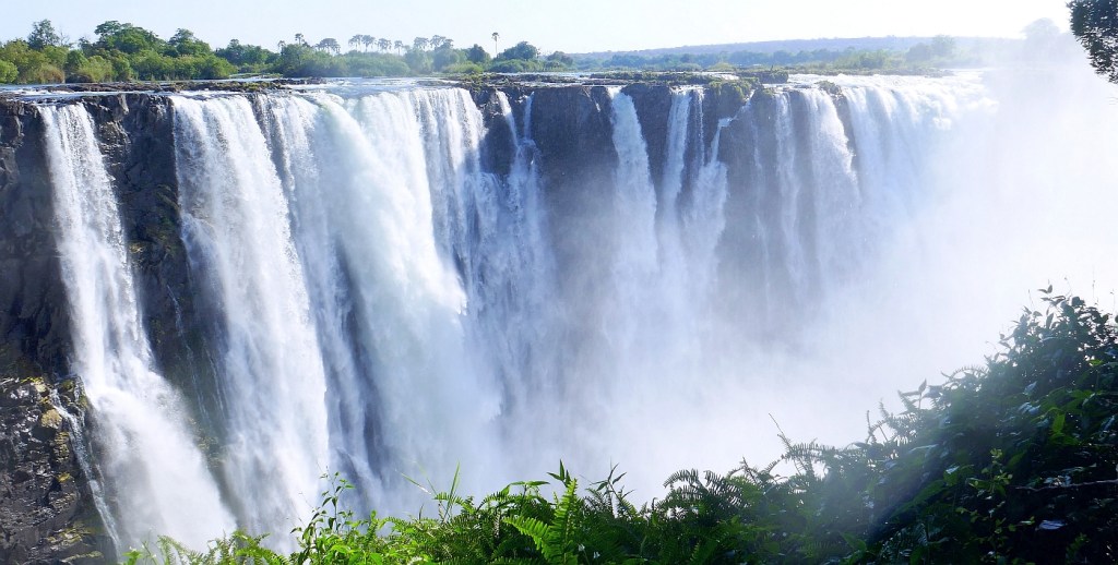
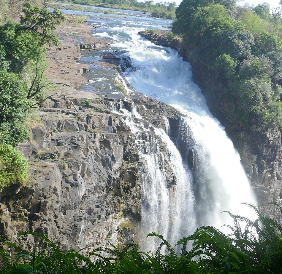
The photo on the left below shows the last waterfall in the series of 16 waterfalls that make up Victoria Falls. Like the ominous name of the first cataract (Danger Point), the last one is equally threatening, entitled the Devil’s Cataract. This is where the lip of the falls is at its lowest and carries the greatest concentration of water during the flood stage.
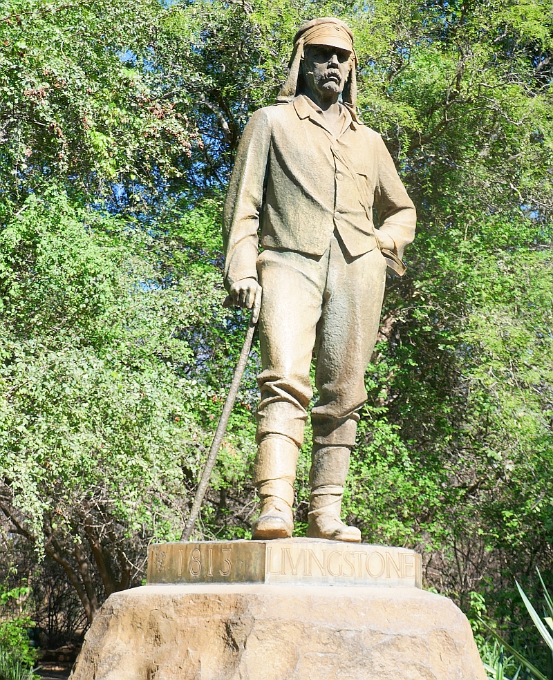
After inspecting the last stage of the waterfall, our path led us to a ceremonial area where various plaques were housed and also the statue of the famous Dr Livingstone is placed. Livingstone was a Scottish Missionary and explorer who arrived here in 1855. He apparently viewed the falls from the Zambian side of the waterfalls on an island in the middle of the Zambezi River that is today called Livingstone Island. He decided he would name the Falls as Victoria Falls after the British Queen of the time. Today these falls are given a local name, Mosi-oa-Tunya (Thundering Silence). This renaming of geographical features in ex-British colonies has taken a long time to occur. In Australia, major geographical landmarks are slowly being renamed with their original indigenous names, the best example being Eyre’s Rock in the Northern Territory which today is named Uluru.